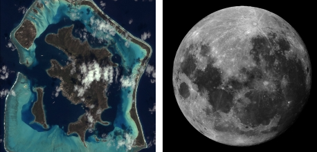
Captions: (L) IKONOS was the first satellite to share public images of many of Earth’s greatest beauties, including a photo of the Bora Bora islands in the French Polynesia collected on October 25, 2001. (R) This image of Jupiter with its moon was taken during a Field Angle Map Stellar Collection, which uses the stars collected to map the optics and sensor geometry during calibration. Credit: DigitalGlobe
[SatNews] It performed on-orbit for more than double its original design life.
DigitalGlobe’s IKONOS commercial imaging satellite, built by Lockheed Martin [NYSE: LMT], was retired on March 31 after more than a 15-year service life. The satellite was owned and operated by DigitalGlobe, Inc., and performed on-orbit for more than double its original design life.
“Over the last 15 years IKONOS captured the moments of both triumph and tragedy that have shaped our world,” said Mike Hamel, vice president and general manager of Lockheed Martin Commercial Space.

IKONOS, launched from Vandenberg Air Force Base, on September 24, 1999, and has taken thousands of photos of Earth for national security, disaster relief, agriculture and more. Carried aboard an Athena rocket, IKONOS traveled into a Low Earth Orbit, approximately 400 miles above the earth.
“Its high resolution images have helped make everyone from first responders and farmers to city planners and surveyors more effective and informed. So much of our technology today relies on publicly-available satellite imagery that it’s easy to take this technology for granted, but IKONOS was a real trailblazer that proved the value of space systems to our world.”
Launched on September 24, 1999, IKONOS was the first satellite to collect and publicly share high-resolution Earth images. Over its lifetime, IKONOS collected more than 400 million square kilometers of Earth imagery, equivalent to more than 40 times the land area of the United States of America.
IKONOS images have been used for national security, disaster relief, agriculture and mapping. Famous images include bird’s-eye views of Olympic villages, the island of Bora Bora and downtown Manhattan in the days following 9/11.
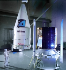
Lockheed Martin is completing the WorldView-4 (previously GeoEye-2) satellite for DigitalGlobe. WorldView-4 is a next generation high-resolution imaging satellite that will provide multispectral imagery to commercial, government and international customers once launched in 2016. Lockheed Martin has built more than 300 remote sensing satellites to commercial, civil and military customers.