[SatNews] Another week another launch for ULA that again involves the U.S.A.F.
Everything is progressing toward the WGS-7 launch for the United States Air Force. The mission is set to lift off on a ULA Delta IV rocket on Wednesday, July 22 from Space Launch Complex 37 at Cape Canaveral Air Force Station in Florida. Today's L-2 forecast continues to show a 60 percent chance of favorable weather conditions for launch. The launch window is 8:07-8:46 p.m. EDT.
Launch Forecast Summary:
Overall probability of violating weather constraints: 40 percent
Primary concern: Anvil Clouds, Lightning and Cumulus Clouds
Overall probability of violating weather constraints for 24 hour delay: 40 percent
Primary concern: Anvil Clouds, Lightning and Cumulus Clouds The live broadcast will begin at 7:47 p.m. EDT.

Courtesy of Boeing
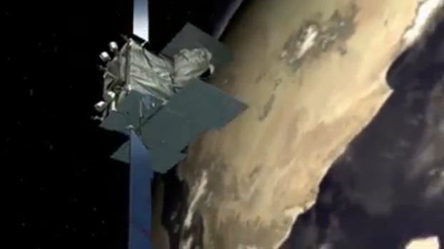
WGS satellites are important elements of a new high-capacity satellite communications system providing enhanced communications capabilities to America's troops in the field for the next decade and beyond. WGS enables more robust and flexible execution of Command and Control, Communications Computers, Intelligence, Surveillance, and Reconnaissance (C4ISR), as well as battle management and combat support information functions. The WGS constellation augments the existing service available through the UHF Follow-on satellite by providing enhanced information broadcast capabilities.
WGS-7 will be the 30th Delta IV mission since the vehicle's inaugural flight in 2002. This is the fifth flight in the Medium+ (5,4) configuration, and all launches in this configuration were WGS missions.
WGS-7, the first Block II Follow-on satellite, supports communications links in the X-band and Ka-band spectra. While Block I and II satellites can instantaneously filter and downlink up to 4.575 MHz from 39 primary channels, WGS-7 can filter and downlink up to 5.375 MHz from 46 primary channels.
As with the Block II satellites, WGS-7 includes a high-bandwidth radio frequency (RF) bypass capability, which allows for larger bandwidth allocations to users. Depending on the mix of ground terminals, data rates, and modulation and coding schemes employed, a single WGS satellite can support data transmission rates between 2.1 and 3.6 Gbps.
WGS-7 also allows for up to ~800 MHz of additional bandwidth through the use of “Redundant Port Activation.”
WGS has 19 independent coverage areas, 18 of which can be positioned throughout its field-of-view. This includes eight steerable/shapeable X-band beams formed by separate transmit/receive phased arrays; 10 Ka-band beams served by independently steerable diplexed antennas; and one transmit/ receive X-band Earth-coverage beam. WGS can tailor coverage areas and connect X-band and Ka-band users anywhere within its field-of-view.
Five globally-located Army Wideband SATCOM Operations Centers provide 24/7 payload monitoring and command and control of the WGS constellation. Each Global Satellite Configuration and Control Element has the capability to control up to three satellites at a time.
Spacecraft platform control and anomaly resolution is accomplished by the 3rd Space Operations Squadron at Schriever Air Force Base in Colorado Springs, Colorado.