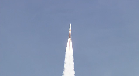
And it's a go!

Cape Canaveral Air Force Station, Fla. (March 25, 2015) - A United Launch Alliance Delta IV rocket stands ready for launch at Space Launch Complex-37 with the GPS IIF-9 payload. Launch is scheduled for this afternoon at 2:36 p.m. EDT. GPS IIF-9 is the ninth in a series of next generation GPS satellites and will join a worldwide timing and navigation system utilizing 24 satellites in six different planes, with a minimum of four satellites per plane positioned in orbit approximately 11,000 miles above the Earth’s surface.
Photo: United Launch Alliance
[SatNews] Fog didn't dampen the spirits of those involved in a successful launch today of the GPS IIF-9 launch for the United States Air Force. The mission liftoff was 2:36 p.m. EDT on a ULA Delta IV rocket from Space Launch Complex 37 at Cape Canaveral Air Force Station in Florida.
Mission Description: GPS satellites serve and protect our warfighters by providing navigational assistance for U.S. military operations on land, at sea, and in the air. Civilian users around the world also use and depend on GPS for highly accurate time, location, and velocity information.
GPS IIF-9 is one of the next-generation GPS satellites, incorporating various improvements to provide greater accuracy, increased signals, and enhanced performance for users.
A United Launch Alliance Delta IV Medium+ (4,2) will deliver the GPS IIF-9 satellite to semi-synchronous circular orbit. Liftoff will occur from Space Launch Complex 37 at Cape Canaveral Air Force Station, Florida.
The Navstar Global Positioning System (GPS) is a constellation of satellites that provides navigation data to military and civilian users worldwide. The system is operated and controlled by the 50th Space Wing, located at Schriever Air Force Base, Colorado.
Jim Sponnick, VP, Atlas and Delta Programs said, "The ULA team is proud to be the launch provider for the U.S. Air Force (USAF) Global Positioning System (GPS) Directorate by delivering replenishment satellites aboard Atlas V and Delta IV launch vehicles. GPS IIF-9 is one of the next generation GPS satellites, incorporating various improvements to provide greater accuracy, increased signals, and enhanced performance for users."
GPS utilizes 24 satellites, in six different planes, with a minimum of four satellites per plane, positioned in orbit approximately 11,000 miles above the Earth’s surface. The satellites continuously transmit digital radio signals pertaining to the exact time (using atomic clocks) and exact location of the satellites. The GPS IIF series have a design life of 12 years. With the proper equipment, users can receive these signals to calculate time, location, and velocity. The signals are so accurate that time can be measured to within a millionth of a second, velocity within a fraction of a mile per hour, and location to within feet. Receivers have been developed for use in aircraft, ships, land vehicles, and to hand carry.
The ULA team is focused on attaining Perfect Product Delivery for the GPS IIF-9 mission, which includes a relentless focus on mission suc- cess (the perfect product) and also excellence and continuous improvement in meeting all of the needs of our customers (the perfect delivery).
As a result of increased civil and commercial use as well as experience in military operations, the USAF has added the following capabilities and technologies to the GPS IIF series to sustain the space and control segments while improving mission performance:
- Two times greater predicted signal accuracy than heritage satellites.
- New L5 signals for more robust civil and commercial aviation.
- An on-orbit, reprogrammable processor, receiving software uploads for improved system operation.
- Military signal “M-code” and variable power for better resistance to jamming hostile environments, meeting the needs of emerging doctrines of navigation warfare