[SatNews] The European Space Agency (ESA) has selected Airbus Defence and Space as the prime contractor to develop and construct the first Jason-CS/Sentinel-6 satellite.

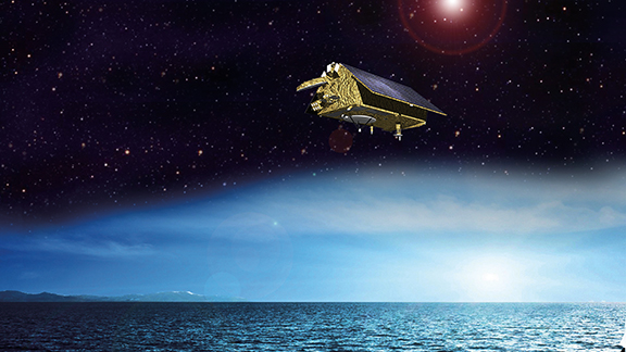
Artistic rendition of the Jason-CS/Sentinel-6 satellite.
Image courtesy of Airbus D&S.
Jason-CS/Sentinel-6 is a mission to carry out high-precision measurements of ocean surface topography. The satellite will measure its distance to the ocean surface with an accuracy of a few centimeters and use this data to map the topography globally, repeating the cycle every ten days. Observing changes in sea-surface height using such a high level of accuracy provides insights into global sea levels, the speed and direction of ocean currents, and ocean heat storage. The measurements made are vital for modelling the oceans and predicting rises in sea levels.

The Sentinel-6 mission is part of the European Earth observation program Copernicus, and is a continuation of a program of global ocean-surface measurements made by satellites that began in 1992. Weighing around 1 ton and flying at an altitude of around 1,300 kilometers, the Jason-CS/Sentinel-6 satellite will ensure that measurements are carried out on a continuous basis from 2020. The satellite is designed to orbit for five and a half years, and operations will be overseen and managed by EUMETSAT in Darmstadt, Germany. Development of the satellite will be based on the highly successful CryoSat program.
“For this project we will rely not only upon the proven and efficient designs and processes applied to numerous Earth observation missions, but also, of course, upon the experienced Cryosat team of experts,” said François Auque, Head of Space Systems.
As with CryoSat, Airbus Defence and Space in Friedrichshafen will be the prime contractor for the space segment and heads the industry consortium on behalf of ESA. Thales Alenia Space France will construct the main instrument, a radar altimeter, whose predecessor is already being used on CryoSat-2. Further instruments are being constructed by NASA/JPL in the USA and provided by the American National Oceanic and Atmospheric Administration for the Jason-CS/Sentinel-6 mission.
Additional information regarding ESA is accessible via http://www.esa.int/
For more Airbus D&S information, please visit http://www.airbusdefenceandspace.com/