[SatNews] Today, the Spinning Enhanced Visible and Infrared Imager (SEVIRI) instrument on MSG-4 captured its first image of Earth. This demonstrates that Europe’s latest geostationary weather satellite, launched on July 15, is performing well and is on its way to becoming fully operational when needed after six months of commissioning.
The European Space Agency (ESA) was responsible for the initial operations after launch (the so-called launch and early orbit phase) of MSG-4 and handed over the satellite to EUMETSAT on July 26.
The first image is a joint achievement by ESA, EUMETSAT, and the European space industry. For its mandatory programs, EUMETSAT relies on ESA for the development of new satellites and procuring the recurrent satellites like MSG-4. This cooperation model has made Europe a world leader in satellite meteorology by making best use of the two agencies’ expertise.

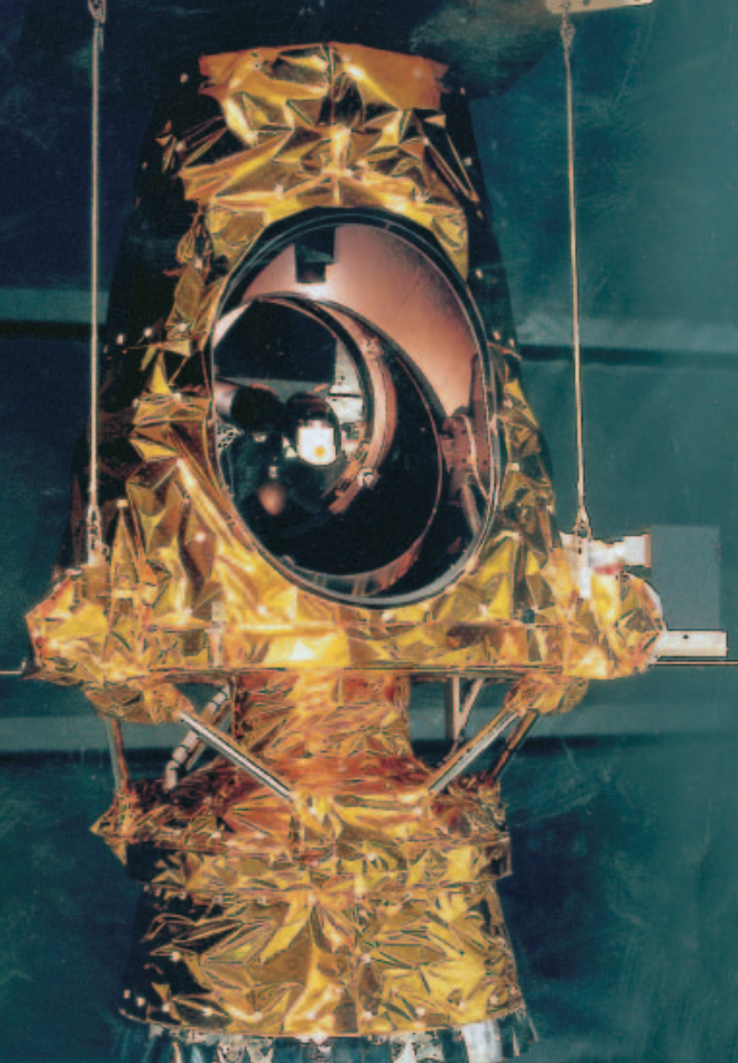
The main SEVIRI instrument unit.
The MSG satellite’s main payload is the optical imaging radiometer, the so-called Spinning Enhanced Visible and Infrared Imager (SEVIRI). With its 12 spectral channels, SEVIRI will provide 20 times more information than the current Meteosat satellites, offering new and, in some cases, unique capabilities for cloud imaging and tracking, fog detection, measurement of the Earth-surface and cloud-top temperatures, tracking of ozone patterns, as well as many other improved measurements. The SEVIRI instrument has been manufactured by European industry under the leadership of Astrium SAS in Toulouse, France.
SEVIRI is a 50 cm-diameter aperture, line-by-line scanning radiometer, which provides image data in four Visible and Near-InfraRed (VNIR) channels and eight InfraRed (IR) channels. A key feature of this imaging instrument is its continuous imaging of the Earth in 12 spectral channels with a baseline repeat cycle of 15 min. The imaging sampling distance is 3 km at the sub-satellite point for standard channels, and down to 1 km for the High Resolution Visible (HRV) channel.
The SEVIRI instrument is composed of a Telescope and Scan Assembly (TSA), a Focal Plane and Cooler Assembly (FPCA), and an Electronic Unit Assembly (EUA) (Figs. 2 & 3). The EUA, which controls SEVIRI and processes its data, consists of three electronics boxes located on the satellite main platform, namely the Functional Control Unit (FCU) and the Detection Electronics (DE), consisting of the Main Detection Unit (MDU) and the Preamplifier.